What three nights up here actually get you
A Cameron Highlands vacation package from this office covers three nights at Tanah Rata, which sits at 1,440 meters on a plateau folded out of the Titiwangsa Range. You arrive by road. The plateau has three ways in: the old climb from Tapah, the wider road from Simpang Pulai, and the eastern road that comes over from the Kuala Lipis side. All three take hours and all three wind.
The 980 is a person, not a couple, and assumes the two of you share one room. It buys the room for three nights, the road up and down, one day with a driver on the ridge, and a day of walking with somebody who knows which paths are open. Getting yourself to Malaysia is your own affair and is not priced here.
Three nights is enough for one mountain, one long walk in the forest, and one slow morning among the tea. It is not enough to do all of that plus the farms plus the market in the same stretch, and people who try it spend the whole stay in a car on a road built for a fraction of the traffic it now carries.
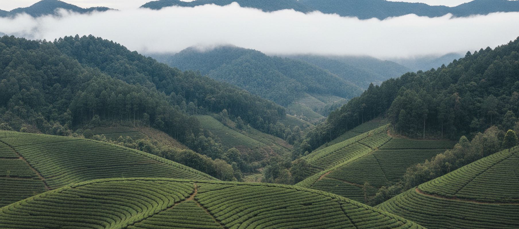
The tea sits on slopes nobody would farm otherwise
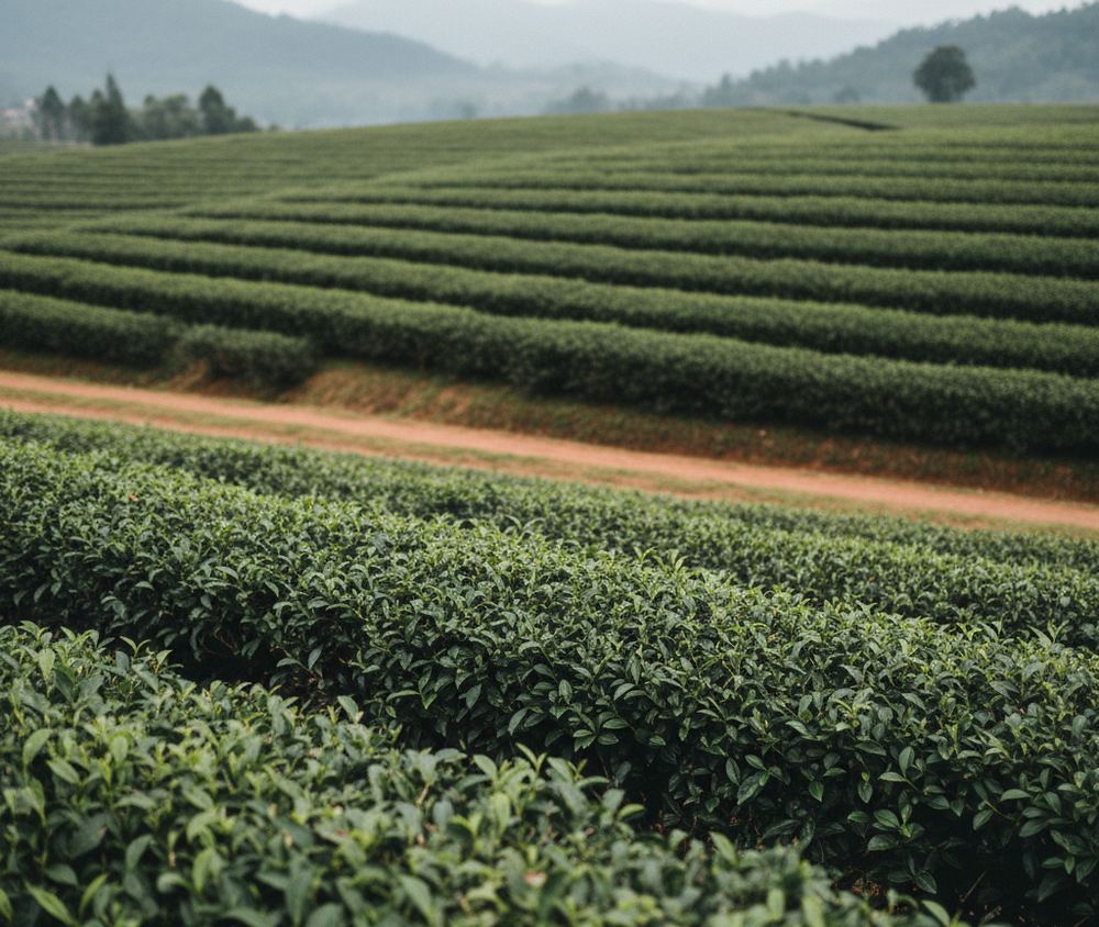
Tea covers the steep ground north of Brinchang and south toward Ringlet, planted along the contour so the rows read as green ribs on a hillside. The bushes are kept at waist height because that is the height a picker can work. Between them run narrow service tracks, and the drop below the outer rows is real. Stand on the edge and you are looking down a slope no vegetable would hold on to.
Some estates keep a room open to visitors, with a terrace over the fields and a window into the withering and rolling floors. One of them asks a few ringgit at the gate. They open in the morning and close in the late afternoon, and the approach roads are single track with passing places, so a car meeting a truck has to reverse to the last wide spot.
Picking is done by hand on the steepest blocks and elsewhere with a long shear that two people carry, one at each end. Whether you see any of it depends on the day and the block, since the fields are worked on a cycle and not for an audience. The tea rooms are plain, the pots are large, and nobody moves you off the terrace.
Gunung Brinchang and the forest on the ridge
Gunung Brinchang stands at 2,032 meters and a paved road runs to the summit, about twelve kilometers of it from Brinchang town, climbing the whole way in first and second gear. Walking the road takes roughly three hours up. There is a tower at the summit that puts you above the canopy and out over the Titiwangsa Range, and there are mornings when it puts you inside a cloud instead.
Below the summit the forest changes. The trees are short and bent, every branch carrying moss and small ferns, and the ground underneath is peat that holds water like a sponge. A plank walk was laid through one stretch after boots wore the surface away, and you keep to the planks. What grows beside them is thinner than it was twenty years ago, and nobody pretends otherwise.
Beyond the plank walk a path runs along the ridge to Gunung Irau at 2,091 meters. It is root, mud and moss the whole way, hands as often as feet, and it has been closed since a landslip years ago. Assume it is shut until the office tells you otherwise. A numbered path also used to climb from the town to the summit, and it has spent recent years closed at the upper end, so the road is the dependable way up.
The numbered paths, and what they are really like
The forestry department gives these paths numbers instead of names, and the numbers run to fourteen. Number 4 is the short walk to Parit Falls and is paved most of the way. Number 10 climbs to Gunung Jasar at 1,696 meters in about an hour and a half of steady work. The stream below Parit carries what the town puts into it, so look at the water falling and not at the pool.
Numbers 3, 7 and 8 all end up on Gunung Berembun at 1,840 meters and none of them is a stroll. Number 8 starts near Robinson Falls and goes up hard. Expect wet clay, roots used as steps, stream crossings without bridges, and stretches where the path is a trench worn below the root line. Leeches come out after rain. Boots with a bite, not sneakers.
Closures are the thing to understand. Landslips shut paths for months, one or two have been shut for years, and the sign at the head of a path does not always say so. The office asks locally before you go and writes down what is walkable that week, and the guided day is set aside for exactly this, since a person who walked it on Tuesday beats any map.
Farms, the old houses, and who should skip this
The plateau feeds a good part of the country. Terraces of cabbage, lettuce and leaf vegetables run right up to the tree line, and the strawberry houses sit under plastic on frames at chest height so the fruit hangs clear. You can pick your own by weight at several of them. The roadside market north of Brinchang sells what came off those slopes that morning, along with a lot that did not.
The plateau was surveyed in 1885 and built up from the 1920s, and brick and timber houses from that period still stand at Tanah Rata and around Brinchang, some kept up as places to stay, some shuttered behind their hedges. Nights run down toward 10 degrees Celsius on the high ground, which is about fifty in Fahrenheit. Rooms are unheated. A sweater and something windproof earn their place in the bag.
Skip it if you want to lie still by water, if steep wet ground is a problem for your knees, or if a plateau with one road through it and traffic on that road is going to spoil the quiet you came for. It is a working farming district that happens to be cool, not a retreat, and weekends bring the lowlands up in numbers.
What here answers to somebody else and not to you
- No part of this stay runs to a schedule. There is no group to join, no vehicle to catch at first light, and nobody holding a place for you at an hour written down in advance.
- The paved road to the summit of Gunung Brinchang is a public road, roughly twelve kilometers of it from Brinchang town, so the climb happens when you decide it happens and you turn back when you have had enough.
- The paths out of Tanah Rata begin at a road end rather than at a barrier or a desk, and you can start one after breakfast, at noon, or not at all. The only person who needs to know is whoever you are staying with.
- One thing does keep hours: the estate tea rooms open in the morning and close in the late afternoon. The days stay free anyway, because there is no place to hold and nothing to be on time for. You go while the door is open, or you go the next day.
The hatching beside each price says how much of the trip runs to somebody else's timetable: one line for none of it, four for a trip built around fixed departures from the first morning to the last.
What the figure holds and what it leaves to you
Held inside the figure
- Three nights in a plain room at Tanah Rata, two people sharing, with blankets and hot water.
- Breakfast on all three mornings where you are staying.
- Car and driver up from the lowlands at the start and back down at the end.
- One full day with a car and driver on the ridge road north of Brinchang, waiting time included.
- One day of walking with a guide who lives on the plateau, on paths checked that week.
- A written sheet before you travel listing the numbered paths, which of them are open that month, and any forest department paperwork the reserve asks for, filed on your dates.
Left outside it, on purpose
- Getting yourself to Malaysia and home again. No passage by air or over water is arranged, priced or held by this office.
- Lunches, dinners and drinks across the three days.
- Entry charges at the estates, at the farms and on the ridge.
- A room to yourself. The price assumes two people in one room, and single occupancy costs more and has to be asked for.
- Anything on the days you walk alone: a taxi out to a road end, food you carry, wet weather gear and a stick.
- Laundry, telephone charges, and whatever you buy at the roadside market or bring home from it.
A price on this site covers the ground only: the rooms, the named transfers between them, and the people who meet you. It does not cover getting to the country or leaving it.
Send the dates you have in mind and the office writes back with the room, the driver's day, the walking day and the whole price for each of you, and nothing is held until you say so.
The months this one is worth the journey
There is no dry season worth the name. Rainfall on the plateau runs well past 2,700 millimeters a year, and most of it comes in the afternoon, which is why walking here is a morning habit. January, February and June are the drier stretches. October is the wettest month in the record, November is close behind, and cloud can sit on the ridge for days at a time in either.
Nothing shuts for a wet season, which is why this page carries no seasonal warning. What changes is the ground. A path that is firm underfoot in February is worked clay in November, and landslips come in the wet months rather than the dry ones. Malaysian school holidays and long weekends also put a lot of cars on the single road through Brinchang, so the middle of a week moves more easily than a Saturday.
What this one will join to
- Ipoh and Cameron Highlands vacation package, Road, and only road. A private car with a driver, or the public bus if you would rather., Two hours to two and a half by car, by way of Simpang Pulai. Scheduled buses out of Ipoh are quoted at two to three hours.
- the highlands and rainforest vacation package, Road, then river, About eight hours moving, closer to ten door to door
Tell the office what the three days should look like and it will put the ground arrangements together and send them over for you to read before anything is booked.
Asked about this one more than once
- How fit do you need to be for this?
Fit enough to walk uphill on wet ground for two or three hours. The tea terraces, the summit road and the plank walk ask nothing of you beyond standing up and looking. The forest paths toward Gunung Berembun are a different matter and are honest hill work on clay, roots and stream crossings with no bridges.
- What if a path we wanted is closed?
That happens here more than in most places. The department closes paths after landslips and does not always announce it, and a map four years old will show you paths that are no longer there on the ground. We ask the week before you travel and again once you arrive, and the guided day exists so that at least one of your walks is on ground somebody covered recently.
- How do we get up there, and is that in the price?
By road, and that is the only way in. The climb from the lowlands takes a couple of hours on a winding two lane road, and the car both ways is in the price. Getting yourself to Malaysia is not. This office arranges what happens on the ground inside the country and nothing that moves you by air or over water.
Reserve a month rather than a date
Tell the office which month you have in mind and it will answer with what that month makes possible and what it shuts.